
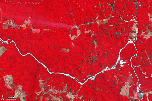
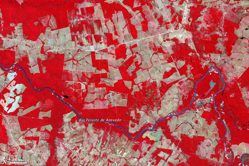
The Thematic Mapper on NASA’s Landsat 5 satellite captured the top image of part of Mato Grosso on August 6, 1992. The Advanced Spaceborne Thermal Emission and Relfection Radiometer (ASTER) on NASA’s Terra satellite captured the bottom image of the same area on July 28, 2006. In both of these false-color images, red indicates vegetation, and the brighter the red, the denser the vegetation. The Rio Peixoto de Azevedo appears pale blue, nearly white, in 1992, perhaps a combination of reflective sediment or sunlight glinting off the water.
More @ NASA Earth Observatory
1 comment:
The images is very nice and excellent.
Post a Comment